People of the Parks 2018
What makes parks special is that they are public space - that they are used by people. People and the public play an intrinsic role in giving our parks use, character, and value.
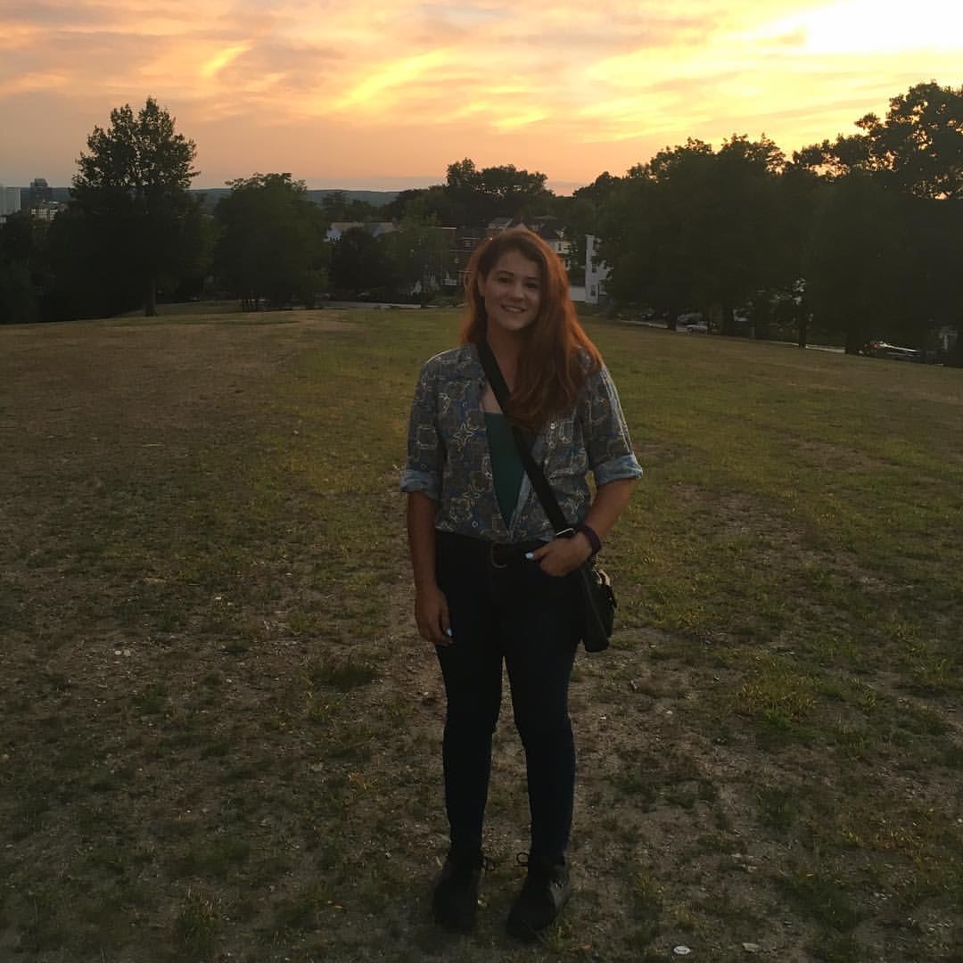
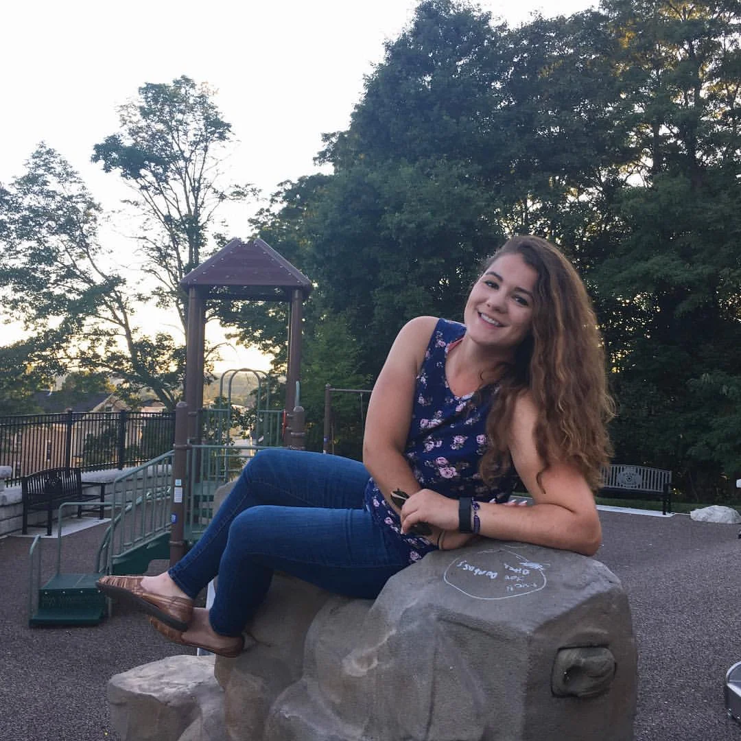
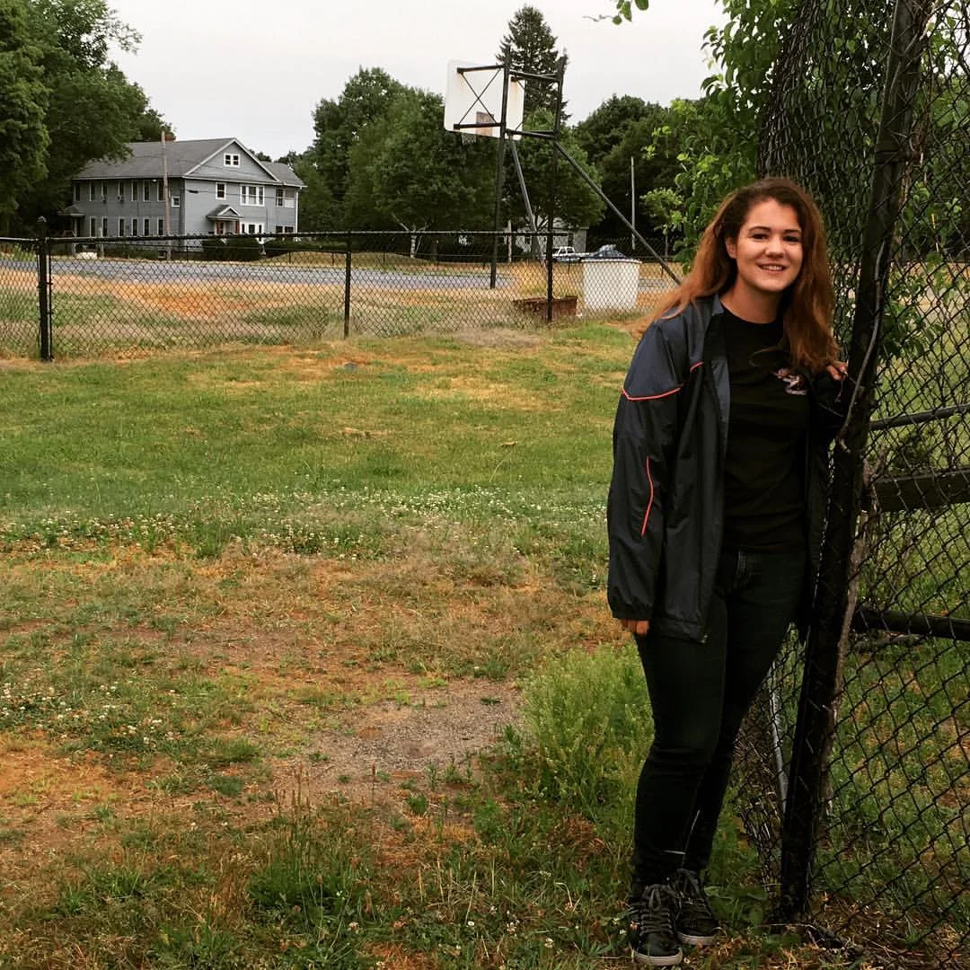
Over the past two summers, Park Spirit President Brittany Miller Legasey has journeyed to each of Worcester's 60 parks on a 'tour', documenting the visit with photographs and posting a photograph online along with information about park resources and history.
This summer, Legasey will embark on another park tour, but this summer park users, friends, and advocates will be our guides through Worcester's parks. The People of the Park tour will celebrate our parks' and those that make them what they are.
In addition to photographs, personal perspectives, and the inside scoop from the People of the Park and sharing that information on parkspirit.org, Park Spirit will also be compiling all park information into a web page for each park - part of a larger, long term effort to make park history and informational publicly accessible on the web.
Be part of the tour!
We want to feature any and all park users, to provide a diverse and accurate portrayal of how the parks are used, what is thought about them, and how they play a role in Worcester life.
In 2016, my first park tour was a personal challenge and a social media experiment.
The encouragement, feedback, and response that I received from friends, family, fellow volunteers, and strangers showed that exploring, sharing, and celebrating our public spaces together has the potential to be something so much more.
This summer and fall, I'm excited to get back into the parks, create some new memories with my fellow park users, and share the experience and the stories online for all to access and hopefully enjoy.
Take the tour!
Sign up to get park tour updates, stories, and information sent directly to your inbox.
Take the 2016 tour!
#60daysofsummer at Worcester's largest park! Green Hill Park - at 482.4 acres! It's not even a close competition.
The park has a storied history. The Adams family, later the Green family, and finally the city of Worcester managed and maintained the land. It was transformed from wooded hills, to farmland, to a country estate, and finally to the public park that we know today.
Green Hill park has numerous resources, both geographic and manmade. It contains two ponds, a zoo, a picnic area, a playground, a little league field, basketball courts, an 18-hole golf course, handball courts, a restaurant, a pavilion, and a number of hiking trails. Additionally, the Worcester Parks Department headquarters is also located at Green Hill.
The land that is now Green Hill park was first cleared for settlement over three hundred years ago. Aaron Adams, an Englishman and one of the proprietors of the initial land grant, was one of the first to start managing the landscape.
In 1713, a group of settlers, Aaron Adams of Sudbury, England included, purchased eight square miles from the Massachusetts Bay Colony. Adams eventually acquired 81 acres of land and built the first structure in 1714, establishing a farm on Millstone Hill. Around 1724, 100 acres adjacent to the farm was purchased by the town of Worcester to use as a quarry. In 1754, Dr. Thomas Green purchased 180 acres from Adams. This land and land that was added on at a later date became known as ‘Stormont’ or ‘Green Hill’
The son of Dr. Thomas Green, Dr. John Green, inherited the land and built the first Green family homestead in 1757. A generation after this, the Greens had expanded their landholdings, adding fifty acres and forming a small pond in the Bear Brook wetland, where Green Hill pond can be found today. William English Green added more to the property, when he purchased the quarry (although a court decision stated that the public could still mine quarry stone). His son, Andrew Green was given the family land totaling 287 acres in 1848. He increased the property size to 312 acres, transforming the site from a country farm into a large estate. Andrew Green went on to become Commission of Central Park in 1857, his roots in Worcester and support of landscaping and gardening playing a role in the development of his desire to improve city life through the development of parks and cultural institutions. In 1850, Andrew Green divided the original family home and built a new ‘mansion’ in between. His brother Martin Green came to live at the estate and manage it in 1872. Trained as an engineer, Martin Green made the decision to damn the Bear Brook valley and form the present day Green Hill pond.
Andrew Green died in 1903, leaving the estate of 529 acres to his nieces and nephews, who ended up selling the land to the city of Worcester. They contributed $50,000 towards the purchase price of $104,900. The land officially became Green Hill Park on December 27th, 1905.
The Green family mansion remained in the park until 1957, when it was demolished. Vandalism, damage from the hurricane of 1948, and maintenance costs all played a roll in the decision to demolish the mansion.
Only a year after the land became a park, two rooms of the mansion were open to the public for use as ‘resting rooms’ for women and children. One room was used as a laboratory for students to study birds and another room was used as a lecture and meeting room by the Worcester Historical Society. In 1906, attendance at the mansion reached a height of 912 people. Also, in 1906 the Worcester City Missionary Society used the upper two floors of the mansion as a vacation spot for mothers with sick children and for those in need of convalescent care. Two large tents and a portion of the former Crawford Farm barn were also used a children’s hospital during the summer of 1906.
A 9-hole golf course was first constructed in 1919. It was later expanded to 18 holes.
In 1927, construction began the Memorial Grove, a living monument to the citizens of Worcester killed during WWI. It was dedicated in 1928. Unfortunately, many of the trees did not make it to the 21st century, but thanks to work by the Green Hill Park Coalition and the Worcester Tree Initiative, many have been replaced and all of those lost since the original planting will be replaced later this fall.
In 1929, a bowling green was opened next to Lincoln Street (if you remember this from my post about Holland Rink Playground). The bowling green was replaced by a pool, basketball courts, and archery practice area.
The park lost considerable land over the years. 7.24 acres of the park, the highest land at the park located on the top of Millstone Hill, was transferred to the State for the National Guard Armory in 1957. In 1967, the state took another 5 or so acres to construct 290, drastically altering the park land and resources at the Holland Recreation Area. More parkland was also lost for the construction of Worcester Technical High School.
The quarry, located to the left of Skyline drive if you are heading into the park, was used as a dump for many years both legally and illegally and in 1968 it was ordered closed. Considerable dumping took place there during the 40s and 50s and in the 60s the city used the quarry as a dump for building material that was often times burned, creating pollution that disrupted life for those living in the adjacent neighborhood. The quarry was reopened in 1971 as a sanitary landfill managed by the city. It was completed in 1973, graded and revegetated. This is the area on the top of the hill that is now a sports field, across from Worcester Tech. There is also a skate park there!
The Barnyard Zoo opened in 1974 after being refurbished. There were once buffalo, but not after 1974.
The Parks department building, on the former site of the Green Mansion, was dedicated in December of 1976. That building cots about $80,000 and was located on Crown Hill. That building was later removed, although the paved roadway can still be seen traversing the hill, from the Green Hill Parkway entrance. There was also a toboggan run on this hill sometime ago.
The Parks Department headquarters later moved to the Armory building on Skyline Drive, where it is still located today.
In 2002, Green Hill park became the home of the Massachusetts Vietnam Veterans Memorial. The memorial itself is 4 acres of pond, walking paths, flags, and large elegant stones enscribed with the names of each Massachusetts resident who died in combat or as a result of wounds suffered while in action in Vietnam. Some of stones also display the text of letters written home by some of the soldiers who died.
Green Hill park is the 60th Worcester park that I've been to in exactly 60 days! This was a project that I made up and challenged myself to complete, all in the hopes of promoting all of Worcester's 60 parks, their amenities, and everything else they represent. Thank you for following along. I will have one final post to conclude this project, sometime within the next week before the celebratory #60daysofsummer cookout at Green Hill on Friday, September 9th :)!
#60dayofsummer at the Knights of Columbus property! This is one of Worcester’s newest park, hence why it’s called ‘property’ and the 59th park I’ve been to on my #60daysofsummer tour of Worcester’s 60 parks.
I’m pictured here at Reed Field, located on the former Knights of Columbus property. It features a rectangular field for soccer and football, a new playground, and ample parking. This has been a city park since 2005, the new field and other amenities being complete a few years ago. However, there is no signage at the park designating what it’s called or even that it’s called Reed Field.
Interesting, the announcement for this park was made by former Presidential Candidate and Mass Governor Mitt Romney. The Romney administration earmarked $500,000 for the city's purchase of the seven acres of former Knights of Columbus woodland. That contribution paid for almost half of the $1.7 million dollar pay tag. The rest of the funds from the city, who paid some and also borrowed a bit in block grants to pay for it, and also the Greater Worcester Land Trust donated $145,000.
Also this park is also one of the 17 green spaces along Park Spirit’s East West Trail.
The Knights of Columbus property completes my coverage of the Coes quintuplicate parks, the others being Coes Pond Beach, Coes Knife Property, Columbus Park, and the Fenton parcel (the Fenton parcel is a city property but not technically a park).
You can access this new park off from East Circuit Ave.
#60daysofsummer at Grafton Hill’s Mulcahy Field. This four-acre park is located on Dorchester Street right next to East Middle School. Mulcahy Field has been a park since 1946, when it was transferred from the school department.
This park features three ball fields, a playground, a basketball court, and a batting cage. There is also a park building with public restrooms, but it appeared to be locked up and in disuse. Mulcahy Field is the home of Tom Ash Little League
The city has plans to move the basketball court closer to Dorchester Street, make the playground area larger, and to redo both the baseball and softball fields, moving them closer together so that a walking can be installed around the perimeter of the park.
This is the 58th park that I’ve been to on my #60daysofsummer tour of Worcester’s 60 parks.
#60daysofsummer at Coes Knife Property! This was the site of the former Coes Knife Factory, at which the monkey wrench was invented in 1840. The city acquired the property not too long ago to become park land, since the factory had been long removed. The site features a newly installed bridge connecting Coes Knife to Columbus Park. If you head over there now you will see the site is under construction, as preparations are underway for a million dollar multi-generational, all accessible playground. Worcester's historic Sterns Tavern is also being moved to the site to be managed by the Seven Hills Foundation. This 21 acre park doesn't currently feature much, but it soon will and it's spectacular views and vistas will be there nonetheless. This is the 56th park I've been to on my #60daysofsummer quest to visit all the parks in Worcester! Four more to go!
#60daysofsummer at Ty Cobb Field! The city lists this spot on its park register, but I wasn't able to locate any information about its history. Ty Cobb features three ball fields, one of which has bleachers and a concession stand. The park is maintained by Ty Cobb Little League, which is a nonprofit organization and they take care of the property's maintenance. Another mysterious one. You can find this park located off James Street near the Worcester-Auburn line. This is park number 55 on my #60daysofsummer tour of Worcester's 60 parks.
#60daysofsummer at Worcester’s iconic Salisbury Park. I’m sure you’ve heard of this park, or maybe even been there, but probably don’t know that it’s called Salisbury Park. It’s most famous for Bancroft Tower, the 116 year old castle-esq monument named after Worcester native, former Secretary of the Navy, diplomat, and historian George Bancroft. The tower was built by Stephen Salisbury III, the last of the Worcester’s esteemed Salisbury family, who built it to honor Bancroft who was his father’s childhood friend.
The tower was built in 1900 using horses and carriages to transport the large stones up Prospect Hill. The land the tower was built on was owned by Salisbury. The area around the tower did not become a park until 1912, when the Trustees of the Worcester Art Museum donated it to the city (Stephen Salisbury III left much of his estate to the Art Museum).
Salisbury Park itself extends down almost to Park Ave, as it includes both of the wooded areas that line Massachusetts Ave. The paved road around the Tower was open for driving until the 70s-80s, when it was closed off with the current stone pillars. The Tower itself was open to the general public until the 1980s, but due to illicit activity going on their and the danger that the unmonitored 56-foot Tower poses.
Salisbury Park features Bancroft Tower, parking adjacent to the Tower, and a segment of the East West that runs through the steep, wooded area of the park - leading down to Park Ave towards Institute Park. The trail had been overgrown for many years and it was only this past summer that the Park Stewards Summer Workers recut the trail to incorporate it into the cross-city East West Trail.
In 2014, Park Spirit of Worcester, Inc, reopened the tower to the general public in a series at which the park, the tower, and its history were presented by docents from Preservation Worcester on Sundays in October. The event continued in 2015 and I’m happy to announce that it will be open for the five Sundays this October from 10-2!
This is the 54th park that I’ve been to on my #60daysofsummer tour of all of Worcester’s 60 parks in the hopes of promoting the parks and their amenities.
#60daysofsummer at Quinsigamond Lake State Park! This is not a city park, but for some reason the city includes it in its total 60 parks. I will update with the historical information later, but if you're really waiting for it you can read my post in July when I wrote about the city park on the other side of Lake Ave - Lake Park
#60daysofsummer at Indian Lake Beach! Yes, this is a park! Indian Lake Beach is a two acre park on the Eastern shore of Indian Lake, if you hadn’t gathered that through the name. You can find it just off from Gold Star Blvd, via West Boylston Dr and Clason Road. Although the beach is small, it features ample parking - with space for more than 30 cars. It’s located in a very interesting neighborhood, a thickly settled area with both single and multifamily homes.
Indian Lake Beach became a park in 1911, upon the purchase of 1.14 acres from Frank and Mary Stowell. Overtime, land was added to the park a few additional times (1918, .22 acres purchased from Hattie Streeter and 1939, .271 from a tax lien settlement).
This park isn’t in the best of shape. It’s bathhouse facility looks very rundown and doesn’t seem to be open. The beach needs a good raking and some additional sand. But despite all of those issues, all I can say is wow - did this spot have some amazing views.
This is the 52nd park that I’ve been to on my #60daysofsummer tour of all of Worcester’s 60 parks in the hopes of promoting the parks and their amenities.
#60daysofsummer at Harrington Field, Worcester’s 6-acre active recreation area located off from Harrington Way near Plantation Street. I always thought that this park was named after the street it was located on, unbeknownst that both the street and the park are named after former Worcester Mayor Francis A. Harrington.
Harrington served as mayor from 1890-1892. Harrington Field became a park in 1933 when Charles A. Harrington gave the land as a gift to the city in memory of Francis A. Harrington.
This park is the home to Jack Barry Little League and features three ball fields, a playground, and a basketball court. The city has plans to add an additional playground area, excretes stations on a wooded walking path, and to change the orientation of the existing fields.
This is the 51st park that I’ve been to on my #60daysofsummer tour of all of Worcester’s 60 parks in the hopes of promoting the parks and their amenities.
#60daysofsummer at Indian Hill Park! Indian Hill Park s located directly off from Ararat Street on Worcester’s North Side and is the home of Joe Schwartz Little League.
The park was part of a larger parcel of land that included the North Worcester Pubic School, who’s building can still be seen on Indian Hill Road. What is now Indian Hill Park used to be the school yard for the school. The school building was built in 1893, but replaced by the building currently found adjacent to the park in 1923. In 1980, the city sold the school building to the Salter School and the remaining 4.28 acres of the school grounds along Indian Hill Road are made public. It wasn’t until 2005 that the city transferred those 4.28 acres of public land from the jurisdiction of the city manager to the parks department, officially deeming it a park.
Indian Hill Park is home to a memorial that honors five teenagers who passed away in a cabin fire at the top of Indian Hill in 1967.
Only a few years ago, the park featured only a ball field and t-ball field used by Joe Schwartz Little League and a small parking lot. Most of the park was wooded and not developed. The concession stand was built completely by volunteers and is used when baseball related events are held at the park.
Over the past year, the city has dug up what was the parking lot and wooded area and completely transformed it. Once it’s open, the new Indian Hill Park will feature an improved and expanded parking area, playground, rain pavilion, picnic tables, benches, and a basketball court.
This is the 50th park that I’ve been to only my #60daysofsummer tour of Worcester’s 60 parks.
#60daysofsummer at Worcester’s little known Ball Property, also known as the Harvey Ball Conservation Area. This 15 acre park is completely wooded and connects the Broad Meadow Brook Conservation Center and Wildlife Sanctuary with the Blackstone River Bikeway. It features one hiking trail, the Smiley Face Trail, which starts at Granite Street and connects to Broad Meadow Brook’s Sprague Trail.
The land for the Ball Property was secured with a $500,000 grant from the state Department Conservation Services. The Audubon Society fundraised an additional $250,000, which was matched by a contribution from the city.
The land was purchased from the Ball family in 2007. The name of the park and it’s trail were named in honor of the late Harvey Ball, the Worcester native famed for designing the smiley face.
This is the 49th park that I’ve visited on my #60daysofsummer quest to visit all of Worcester’s 60 parks and playgrounds, take a picture, and share it in the hopes of promoting the parks, their history, and their amenities.
#60daysofsummer at Oread Castle Park. This three acre park is replete with history and it's located on the front line of Worcester's fight for the future over crime and drug abuse.
Castle Park is located in Main South in between Main and Chandler Streets (the park can be accessed by Oread Place off from main or Ely St via Queen St off Chandler). However, these are dirt roads, making this park somewhat hard to access despite its very urban setting.
The park is named for the Oread Collegiate Institute which was formerly located on the property. This was one of the first women's colleges in the country, founded in 1848 by Eli Thayer who was a graduate of Brown University and was looking to replicate its academic experience in Worcester.
A castle-like building featuring Gothic architecture was home to the school, but did not remain open for very long as the parties involved in its functioning got tangled up in a land dispute and it was never officially incorporated. After the Oread Collegiate Institute closed, the grand building was used as a school of domestic science, but that school soon closed as well, leaving the building abandoned to crumble into ruin. The building was demolished in the 1930s and the city took the land for taxes in 1949. It officially became a public park in 1954 after the eminent domain case was settled in court.
The park currently features a basketball, a playground and tennis courts. The handball court was removed last year to be relocated when the renovations start this fall.
Those renovations follow when the city approved a master plan for Castle Park in 2014, calling for $1.5 to $2 million in improvements. Those amenities listed above will be moved around to improve the park user experience. The tennis court will be replaced with a paved ‘multi-purpose’ court. The upgraded park will also feature a handicapped-accessible walking path, replacing the park’s current, unevenly paved and somewhat steep winding main path.
This park’s location has made it a bastion of crime and drug use. This summer, the park stewards summer work program pulled 40 needles out of the park’s wooded area. The Main South CDC and the King-Shepard Neighborhood watch has done so much work keeping an eye on the park and seeking to improve it. This park has the potential to be a very positive asset for a densely populated neighborhood for which a well maintained green space with attractive and useful amenities that draw park users from the immediate community and beyond.
This is the 48th park that I’ve visited on my #60daysofsummer quest to visit all of Worcester’s 60 parks and playgrounds, take a picture, and share it in the hopes of promoting the parks, their history, and their amenities.
#60daysofsummer at Great Brook Valley Playground! This park of just under 7 acres is located off from East Mountain Street, although their is stair access from the Great Brook Valley apartments as well. Great Brook Valley Playground is another park that has a name that doesn't reflect its offerings. It doesn't feature a 'playground' structure, but it does have ample parking for the Roberto Clemente ball field. Great Brook Valley Playground became a park in 1953 when it was transferred from the Worcester Housing Authority. This is the 47th park that I've been to on my #60daysofsummer tour of all of Worcester's 60 parks.
#60daysofsummer at Boynton Park! Worcester's most enigmatic park - in the sense that it is a Worcester city park that is located in Paxton. It's also Worcester's second largest park at just over 114 acres!
Boynton Park was given to the city as a gift through the will of Charles D. Boynton. Boynton deeded the space to the city for one dollar, under the intentions that it would be used as a park,hospital or sanitarium for the people of Worcester and Paxton. The city actually debated wether or not to accept the gift, as it was thought that it was too far removed from the population to be much use (this is despite the fact that the trolley stop was located 100 yards away from the park entrance).
What makes Boynton Park really awesome is that it abuts or is connected by trail to several other municipal parks (Cascades Park) and publicly accessible yet privately owned green space (Cascades West, Cascades East, Cascading Waters, Cooks Pond), to which large maps at Boynton refer to as Worcester's Northwest Parklands.
Boynton Park features hiking trails and a large former ball field that is used as the city's unsanctioned dog park. The remnants of a swing set and basketball court are still visible, but not useable enough to be considered amenities. There is also an old legend about the land that is now Boynton Park - 'the Romance of Silver Springs' of which Charles Boynton wrote about for the Society of Antiquity in 1879 in which he claimed an ancient settlement was located on his land, although there were no records of such settlement. According to a former property owner, the settlers had committed some crime and had escaped here from a foreign country to save their lives. Interesting stuff and cool that this is now parkland, regardless of whether or not the legend holds true.
This is the 46th park that I've been to on my #60daysofsummer tour of all of Worcester's 60 parks! Also, many thanks to the Greater Worcester Land Trust to preserving, making publicly accessible, and maintaining much of the land around the two city parks in this area.
#60daysofsummer at Shore Park.
This is one of my favorite parks in Worcester. It has so much potential and such beautiful views, but it’s often overlooked and forgotten.
It wasn’t easy to find information about Shore Park. From what I’ve read online, it was put behind fences and locked up for many years, only used by the police department when they trained their k9s or when a local group hosted a party. The city formed a partnership with the Greendale YMCA and the Bancroft School, both of which are located right next to Shore Park on Shore Drive just off from Grove Street, to keep the beach open and perform general maintenance of the park.
The Y is actually taking this public-private partnership one step further, and is planning on making a number of improvements to the park including replacing the outdated and always closed boat house. They are also going to make the park more flush with the green space located behind the Y.
This is a good sized park and although the beach is the main feature, it also has ample picnic area - including barbecues. There is also a volleyball court set up. Many people were using the lakeside to fish this evening when I went for a swim after work.
This is the 45th park that I’ve been to on my #60daysofsummer quest to visit all of Worcester’s 60 parks and playgrounds in just 60 days.
— atShore Park.
#60daysofsummer at one of Worcester’s newest parks - Providence Street Playground! It was proposed in 2007 as a ‘friendly gesture’ to residents who live near the Ballard Street landfill when the city’s composting operation was moved from Hope Cemetery to Ballard Street.
It was complete in 2010. Interestingly, it was not paid for using the city’s property taxes, but rather money from the city’s sewer enterprise account. While there are usually restrictions on how enterprise account money can be spent, water and sewer upgrades and mitigation are allowed and the playground was considered mitigation.
The playground was estimated to cost about $300,000 but ended up costing closer to $455,000.
After the city council approved the playground plans in 2008, a handful of people questioned the need for a playground here, since there is already a playground across the street at Vernon Hill Park. Providence Street Playground is located right next to Vernon Hill School and almost directly across from Vernon Hill Park.
While the park is officially termed Providence Street Playground, Glodis field, which is directly behind where the playground is now, was the public space precursor. The soccer field is named after William J. Glodis Jr., the late state representative and city democratic committee member from Worcester.
This is the 44th park that I’ve been to on my #60daysofsummer quest to visit all of Worcester’s 60 parks and playgrounds in just 60 days.
#60daysofsummer at Coes Pond Beach! This park of just under two acres is located right along Mill Street and it's one of the five parks that boarders Coes Reservoir, more commonly known as Coes Pond. I don't have any information on how long this has been a public beach/city park, but an acre and a half were taken away from the park in 1962 for the relocation of Mill Street. The beach was filled in and cribs and floats installed in 1929. This is the 43rd park I've visited on my #60daysofsummer quest to visit all of Worcester's 60 parks.
#60daysofsummer at Burncoat Street Playground. This small park of just over an acre is located immediately next to Burncoat Street Elementary School. It became a park in 1933 when it was transferred from the School Department to the Parks Department.
This park features a large playground area, basketball court and tennis courts.
Burncoat Street Playground was recently rebuilt with city money, secured by District 1 City Councilor Tony Economou. It is also one of 10 locations that the city offered a free program for youth ages 7-13 through the recreation Worcester Program.
This is the 42nd park that I’ve been to on my #60daysofsummer quest to visit all of Worcester’s 60 parks and playgrounds in just 60 days.
#60daysofsummer at Worcester’s Ramshorn Island! This unusual and often forgotten park was acquired by the city in 1919.
It is located in Lake Quinsigamond under Route 9’s Kenneth F. Burns Memorial Bridge.
Park access to Ramshorn Island from the old bridge was removed during $89-million bridge rebuild over the past few years. The park is currently only accessible by boat (although I swam there 😊).
The staircase that used to connect the old bridge to the island was removed due to homeless encampments, drug use, and dumping on the island.
Ramshorn Island has historically been home to various boat clubs on Lake Quinsig - the Wachusett Boat Club and the Worcester Motor Boat Club. These organizations used a club house what used to be on the island at various times, starting as early as 1888.
At one time, hotels had been built on the island. The Quinsigamond House was run by Jesse Johnson Coburn, who you may remember from my Lakeview Playground post.
Coburn also developed ‘Lincoln Park’ which was a very early amusement park. It was located where the Lincoln Park Tower, the Worcester Housing Authority property, sits right on the shore next to the bridge and across from Ramshorn Island. At that time, a footbridge connected Ramshorn Island and Lincoln Park (I will post an old picture in the comments). Lincoln Park used to have a carousel, which according to some online discussions appears to have ended up at the Carousel Center Mall in Syracuse, which is where I went to school!
Ramshorn Island was most heavily used when the lake’s bridge was called the ‘causeway’ (this bridge was built during the civil war years) and split the lake in half. Ramshorn island was connected directly to the Causeway.
This park has no amenities. It is hilly and lined with naturalized trees. It has been a struggle trying to figure out how to get here. I really wish there was a way for this park to be more accessible. With its position in the middle of Lake Quinsig, Ramshorn Island has so much potential to offer stunning lake views removed from the hustle and bustle of the lake shore.
This is the 41st park that I’ve been to!
#60daysofsummer at Great Brook Valley’s Tacoma Street Playground. This is a 40-acre park located just off from Clark Street before it meets East Mountain. Another park with a name that sells its resources and potential quite short.
They playground that you see pictured behind me was built in 1999 for $68,500 and was made possible by the Worcester Housing Authority, the Parks Department, and residents of Great Brook Valley. At that time, it was the largest play structure in the city. Residents of Great Brook Valley advocated for a playground to be built at Tacoma Street following the death of an 8-year-old boy who was crushed under a steel road barrier he was playing on.
The playground is located next to where the city swimming pool used to be. If you check out the park today, you will find a very ancient, seemingly hand carved sign designating that you’re at Tacoma Street Pool. The Tacoma Street Pool was one of the last city pools to be built and was removed recently in the city’s efforts to remove all of the municipal swimming pools.
Back in ’99 when the playground was installed, a nature path was also implemented. A good portion of the park is wooded forest and while it’s beautiful, there are no longer any nature paths through the woods.
Tacoma Street Playground features the aforementioned playground, which is in decent shape but could use some repairs, a basketball court, and ample parking. The park boasts small rolling hills and large expanses of open space - particularly where the pool used to be.
The history on Tacoma Street Playground is not very well documented. Although, from what I’ve found out, the park was federally funded by the Department of Interior. The ancient sign I mentioned attributes the park and pool to the Worcester Department of Interior - a mistake by whoever made the sign. Really good stuff!
This is the 40th park that I’ve been to on my #60daysofsummer quest! I only have 20 parks left!
#60daysofsummer bonus update at Worcester's historic Elm Park. I'm here hosting Park Spirit's last Elm Park Summer Concert for this year and figured that I owe everyone an updated picture of Elm Park with some background information, since it was the first picture I posted in this series and I didn't include any park info!
Elm Park was purchased for public use in 1854, which makes it one of the oldest parks in the country - but not the oldest! Contrary to what the plaque on the Edward Winslow Lincoln gate on Russell Street, there are a few parks that are a little bit older than Elm. When the city went to purchase Elm Park, citizens believed that the $11,257 was too much to pay for a 'swamp on the outskirts of the village.' The ponds were built in 1873 as a natural drainage for the wetlands. In the early days, the park was just a pasture and dump site, but Worcester's first parks commission Edward Winslow Lincoln urged the city to develop the park. Newton Hill was added to Elm Park in 1888. In 1909, Fredrick Law Olmstead, landscaper of Central Park and the Biltmore Estate, redesigned the park. More recently, 1.9 million dollars was invested from state and local monies to redo the playground, install light poles, benches, and picnic tables, and refurbish the pond walls. The wooden bridge was also rebuilt, named after Myra Kraft.
#60daysofsummer at Bell Hill Park! This park is located right off from Route 9, Belmont Street, and boasts stunning lakeside vistas.
Bell Hill Pond was formerly known as Bladder Pond. It was Worcester’s first reservoir/water supply in 1845. It was purchased from the State Hospital in 1911 and resdesigned n 1981.
The park itself is about 35 acres, consisting of steep topography with its south slope facing East Park. There are a series of trails through the wooded area, the East Side Trail, works its way up from East Park, through Bell Hill Park and Green Hill Park all the way over to Lake Quinsig. The climb up Bell Hill is really tough, not recommended for novice hikers.
So interestingly, Bell Hill Park is frequently referred to as Chandler Hill Park. This is similar to how East Park is referred to as Christoforo Columbo Park. Officially, Bell Hill Park and East Park are together officially Christoforo Columbo Park, which makes sense because there are no official markings designating where East Park ends and Bell Hill Park begins.
One of my favorite things in this park is the huge athletic field located out behind Bell Hill School. This decently maintained athletic field features two soccer fields. There used to be a rain shelter there, overlooking the field. This is the location from which they launch the fireworks. This field is officially called Jesse Lee Farber Recreation Area, according to the dilapidated sign at the entrance of the trail leading to the field.
I was really glad that the Parks Steward Summer Workers were in Bell Hill Park this year cleaning out a lot of the undergrowth. This park has really struggled with homeless encampments. If the undergrowth were all cleared out and some general improvements made to the walking paths - maybe even a boardwalk around parts of the pond, this would be a really amazing park.
This is the 38th park that I’ve visited on my #60daysofsummer quest to visit all of Worcester’s 60 parks and playgrounds, take a picture, and share it in the hopes of promoting the parks, their history, and their amenities. 22 more to go, it’s going to get interesting.
#60daysofsummer at Burncoat Park, formerly known as North Park! The name changed officially from North Park to Burncoat Park in 1910.
Another of Worcester’s parks with more than 100 years in age, Burncoat Park’s original almost 40 acres were purchased in 1888 from John D. Curtis, Joseph E. Bond, Jane Harris, Alfred Smith and Francis Weatherbee. The city also received North Parkway, which runs next to the park, as gift.
In 1962, the State took just over 8 acres of park land to build interstate 290. Additionally, more parkland, about 4 acres, was given to the school department for the construction of Wawecus Elementary School, leaving the park now at a total of only 16.4 acres of the originally acquired 90.
When the highway was built, the park lost a basketball court, a tennis court, and gardens.
Burncoat Park features two, natural ponds, a smaller one immediately off from the parking area behind the school and a larger one bordered by North Parkway. Before park land was taken for the highway, the larger pond was much larger and there was another small pond right off from Lincoln. Street. There also used to be a stone bridge - officially named Boulder Bridge - located in-between the ponds prior to 290. This bridge was built in 1901 (I will post a picture in the comments). The three ponds had different uses- a small gold fish pond, a large pond for skating, and a small pond for hockey.
Burncoat Park is presently quite overgrown, although still very scenic and nice for walking. The city has plans to improve upon the old road that runs through the park and make it more pedestrian friendly (it’s currently old, choppy pavement). They are also planning on developing a raised boardwalk path around the end of the large pond. The park also features some short wooded trails. Additionally two multi-use, lighted fields will replace the existing ball fields, a new softball field will be crated, a skate park will be built, and exercise stations will be built along the walkways. A new playground has already been built, located right next to the school.
One aspect of this park that I like is the wire fence flag (pictured behind me), decorating Burncoat Park’s border with the 290 access road. This is one of many painted by William S. Coleman III.
This is the 37th park that I’ve visited on my #60daysofsummer quest to visit all of Worcester’s 60 parks and playgrounds, take a picture, and share it in the hopes of promoting the parks, their history, and their amenities.
#60daysofsummer at Greendale’s Kendrick Field! Another park with an ‘official title’ that sells it quite short. Kendrick field is a large park located just off from West Boylston Street on Brooks Street.
This is another historic park, I’m finding out that Worcester’s parks are much older than I thought. The city purchased about 15 acres of land from Mary E. Kendrick and E.R.S. Kendrick in 1909.Further adding to the space, the Charles Morgan heirs gave an additional .175 acres in 1912.
Kendrick Field is the home of Joe Schwartz Little League, so the park features a little league field, two softball fields, a basketball court, a football field and a small playground.
There has been a lot of good news for Kendrick Field lately. Earlier this year, the Worcester Tree Initiative planted trees along perimeter of the little league field, greening up the largely ‘industrial view of Saint-Gobain.
Also, earlier this year a public-private partnership came into being. Kendrick Field abuts Abby Kelly School and the school recently worked with the city to coordinate the development of the football field for their home games. Greendale Youth Football also currently uses the park for their games.
This is another one of Worcester’s parks that used to feature a pool - it seems like I go to one of these every week. So while Kendrick Field lost that attractive amenity, the pool space is now used for football.
In 2013, the city announced that there would be $750,000 worth of improvements made to Kendrick Field, coming from city and state money. Although, details are sparse on what this money will be used for.
This is the 36th park that I’ve visited on my #60daysofsummer quest to visit all of Worcester’s 60 parks and playgrounds, take a picture, and share it in the hopes of promoting the parks, their history, and their amenities.
#60daysofsummer at Grant Square! This park of 1.5 acres is located up Green Hill off Lincoln Street.
Grant Square was acquired as a gift in 1853, making it a very old park.
This past weekend the Green Hill Neighborhood Association celebrated the official reopening of the park at their Annual Community Picnic. Last year, the city completed stage on of the park’s rehab, installing a state-of-the-art playground (which you see me on), a brand new basketball court, and community garden beds.
This is the 35th park that I’ve visited on my #60daysofsummer quest to visit all of Worcester’s 60 parks and playgrounds, take a picture, and share it in the hopes of promoting the parks, their history, and their amenities.
#60daysofsummer at Lakeview Playground. This neighborhood park is located on Lake View Street, which is off from Lake Ave and it is located directly across from Lake View Elementary School.
This is an interesting property, while it’s overseen by the Parks Department and listed as a city park, since 1952 it has been leased for $1 per year from the Roman Catholic Bishop of Worcester under tenancy at will. This makes any large scale upgrades like capital improvements questionable, because of the confusing ownership situation.
Somewhat related but nevertheless interesting is that Lakeview Playground is also located along Agate Street and Lake View Streets, which are two of the first streets developed in this neighborhood - officially termed the Lake View neighborhood. Jesse Johnson Coburn moved to Worcester by way of Vermont and California and was one of the first to see the potential of Lake Quinsigamond for leisure and summer activity. Following this vision, he purchased and developed much of the area. He purchased Ramshorn Island (which is also currently a city park) and the area that is now Lincoln Park Tower. He gave property to churches and schools, some of which the Lake View Congregational Church ended up leasing to the city to provide Lakeview Playground.
Lakeview Playground features a playground in adequate shape, a swing set, a half basketball court, and ample room for a game of catch or a picnic.
This is the 34th park that I’ve visited in as many days! All on my #60daysofsummer quest to visit all of Worcester’s 60 parks and playgrounds, take a picture, and share it in the hopes of promoting the parks, their history, and their amenities.
#60daysofsummer at Worcester's Korean War Memorial. Yes, this is technically a city park! It's a park that's so easy to forget about, although I do always acknowledge and appreciate its presence when passing through the intersection of Foster and Front Streets.
I had never hung out at this park before, but I really enjoyed my time there today because it's set far enough back from the street to feel relaxing and leisurely, despite the fact it's located in one of Worcester's busiest intersections.
This is one of the newest additions to the Worcester park system. The memorial itself was installed in two phases. The first phase involved the installation of a black polished granite wall inscribed with the names of the 191 soldiers from Worcester County that made the ultimate sacrifice during the Korean War. This section of the memorial was dedicated on November 9th, 2003, thousands of people attending the dedication ceremony. The second phase involved the installation of bronze statues of a Korean Era American GI and a Korean Child, representing the 100,000 orphans saved by soldiers during and after the war. They also installed educational signage, additional flags, and a walkway of honor, pictured here in the pentagonal shape around the flag poles, that feature memorial bricks inscribed with the names of Massachusetts fallen war heroes from Iraq, Afghanistan, and the Gulf.
This is the 33rd park that I’ve been to on my #60daysofsummer quest to visit all of Worcester’s 60 parks and playgrounds in just 60 days.
#60daysofsummer at Shale Street ‘Playground’, the small Worcester park that’s in the most dire shape of all of Worcester’s 60 parks and playgrounds.
This small parcel of land of just .78 of an acre is located just off Wall Street on Grafton Hill, in between Wall Street and Shale Street, which is a short private dirt road that runs parallel to Orient Street.
This park is completely undeveloped. When I first checked it out a few years ago, I termed it a trash heap. Although, after actually exploring it a bit, calling it a trash heap would be putting it nicely. There is no clear access point to this park, no signs, no amenities. It is incredibly overgrown with pricker bushes and weeds. It has the tallest grove of Japanese Knotweed, that invasive bamboo like plant, that I’ve ever seen. Those stocks must have been 12-feet high. It was actually pretty beautiful.
In 2014, the city announced that $118,000 would be put aside for improvements toShale Street Playground from the CSX Neighborhood Improvement Fund. Since this announcement, I have not been aware of any formal plans for the park or what the strategy will be. The entire area will need to be completely cut down and cleared out, aside for some very old, beautiful trees. Although, with this park’s position on the west side of Grafton Hill, it could offer some of the most spectacular views of downtown - if designed with this in mind.
Shale Street Playground was purchased in 1982 from four abutters. The Friendly House had plans to redesign the park in 1981 and even prepared a master plan. This, of course, did not come to fruition.
In the early 1990s, the planning and construction of a concrete retaining wall was conducted using Community Development Block Grant Funds. Since then, no notable improvements have been made.
This is the 32nd park that I’ve been to on my #60daysofsummer quest to visit all of Worcester’s 60 parks and playgrounds in just 60 days.
#60daysofsummer at Rockwood Field! This West Side active-recreation area has been in the city's possession for some time, but it recently got a massive makeover. It's worth checking out, you can find it right along Chandler Street. It was transferred from the school department in 1940, officially becoming a park. George Rockwood donated the land in 1940 with the intention of it being made into a park. The land had previously been used as a pasture.
Rockwood Field features five ballfields and a newly installed walking path sponsored by Reliant Medical. The newly created field that is located the farthest back from the parking lot, is best regulation fields in the region.
The fields were all upgraded within the last few years, including lights installed at the Jesse Burkett Little League Field.
Thousands of children have played ball at Rockwood, making it a special place.
This is the 31st park I've visited on my #60daysofsummer quest to visit all of Worcester's 60 parks in just 60 days!
#60daysofsummer at the East Side’s Holmes Field. This is an 8-acre park located on Plantation Street.
It was purchased in 1924 and named after former Worcester mayor Pehr G. Holmes, who donated three fifths of the cost from revenue of the Food Commission, of which he was treasurer. Besides serving as Worcester’s 38th mayor from 1917-1920, he went on to serve as Congressman for the area. Holmes was a Swedish immigrant who established his own Electroplating firm called the Holmes Electrotype Foundry.
This is a cool park, located on an open hilltop and featuring notable city vistas. It currently features a ball field, a playground, a hockey court, and a picnic area. The pool was removed in 2011, but one mosaic section of the wall of the former pool house still stands. It was specifically saved from demolition in 2011, but was supposed to be removed for safety reasons last year and to make space for the new playground. For whatever reason, it’s still standing. The mosaic, named ‘Water Grace' was created by Worcester resident Lance McKee and his nephew William Greenlaw in 1991.
The city currently has plans to redo the baseball field, build a new playground, add two tennis courts, and create walkways around the park.
Also interesting, Holmes field is the home of 'the Willow Geeks’ a local cricket team that competes in the New England Cricket Association.
This is the 30th park that I’ve been to on my #60daysofsummer quest! I’m halfway there in visiting all of Worcester's 60 parks and playgrounds within 60 days, taking a picture there, and sharing it in the hopes of promoting the parks, their history, and their amenities.
Thanks for following along so far and I’ll be sure to keep it coming and keep it interesting for the next 30 days!
#60daysofsummer at Farber Field! This small park is located off from Moreland Street on Camelot Drive on the West Side. This is a cool spot historically, as it was originally a private park, purchased and developed by Dan Farber in 1955. It was donated to the city, officially becoming a city park in 1983. This is a single use park, featuring a soccer field. There is field house there, but it didn't appear to currently be in use. Farber field has been used for youth soccer since the 80s. This is the 29th park I've visited on my #60daysofsummer quest to visit all of Worcester's 60 parks and playgrounds within 60 days, take a picture there, and share it, all in the hopes of promoting the parks, their history, and their amenities.
#60daysofsummer at University Park! I love the vistas at this park, it’s so Worcester with small rolling hills and surrounded by three deckers.
This park is located in Main South right off from Main Street near Clark University. Although many Worcester natives call it Crystal Park, that name was never made official.
This is another of Worcester’s older parks, the land being purchased in 1887 and 1889 from Sarah Anderson, Sylvia Gates, William D. Gates and Alonzo Whitcomb.
University Park was a popular community gathering space during the 1940s, 50s, and 60s. Organized activities for children were offered at the park, such as arts and crafts and swimming lessons. It was a destination for swimming in the summer, ice-skating in the winter, picnicking, and fishing.
Those water based activities would have taken place in Crystal Pond, which you see behind me in the picture. If you’ve seen this small pond located in the middle of the park lately, you definitely know that it’s not used for swimming.
Upon the parks initial design and historically, the park was used for passive recreation, but over time active recreational amenities were added, such as a swimming pool, basketball court, volleyball/tennis court, and playground.
The swimming poll was removed, but the basketball courts are probably some of the best I’ve seen in the city and named after Worcester Native and Celtics star Bob Cousy. Also new volley ball courts have been installed and are widely used.
There are plans to build a spray park - to replace the pool - near the playground. Although, the spray park won’t have any above ground water features, so that it can also be used as a patio. The master plan also stipulates that security cameras will be installed throughout the park.
This is the 28th park that I’ve visited! 32 more to go on my #60daysofsummer quest to visit all of Worcester's 60 parks and playgrounds within 60 days, take a picture there, and share it in the hopes of promoting the parks, their history, and their amenities.
#60daysofsummer at Apricot Street Playground. Gosh, what an interesting and obscure spot. It’s really hard to know what’s going on at this park. Apricot Street Playground is located on the corner of Merchant and Apricot Streets near the Worcester-Leicester line just past Webster Square.
This is a really strange park. It’s located right across the street from Sullivan Middle School and Parson’s Cider Mill, which is a publicly accessible green space made available by the Greater Worcester Land Trust. There are so many trees and so much green space in this area that I think this has worked against Apricot Street Playground, since much of the area suburban-residential properties with large yard areas.
The park features a small playground apparatus, a swing set, and a few picnic tables. It’s about a 2-acre park, most of which is covered by trees and undergrowth. The site does feature a very large paved area, but the paved area has no visible vehicle access points, leading me to believe it hasn’t been used for a parking lot in some time. The baseball-field-sized paved area is also completely surrounded by trees, making it a somewhat unusual and secluded vantage point.
Apricot Street playground was transferred from the Water Department, becoming a city park in 1940. There is still a water pumping station located on the Apricot-Merchant Street corner, which seems to be in use.
In 1977, residents of the neighborhood asked to discontinue operation of the park because of problems with vandalism and crime there. Henceforth, the park was effectively abandoned and used as a dumping area.
Fastforward to 2016, the playground area is in better shape than others that I’ve seen (Cookson Field, Hadwen Park, Oakland Heights Playground) and the park was both surprisingly and impressively clean. I didn’t notice any trash. What happened in-between its dark age in the 70s and now? I can’t be sure, but I’d really love to know.
There is a dearth of information about Apricot Street Playground available, I could not find any recent updates about this park or its maintenance.
Another interesting yet obscure one. This makes 27 parks that I’ve visited on my #60daysofsummer quest to visit all of Worcester's 60 parks and playgrounds within 60 days, take a picture there, and share it in the hopes of promoting the parks, their history, and their amenities.
#60daysofsummer at Banis Park! This is a small park located on the corner of Dorchester and Houghton Streets. At just under a half acre, 2,500 square feet, this park is much needed green space in a neighborhood crowded with three deckers.
Banis Park was acquired by the city in 1947, although I could not find out how this happened. The park is named for its location, as it is situated in ‘Banis Square’. Both the park and the square memorialize S/Sgt. Joseph J. Banis and T/Sgt. Paul P. Banis, brothers who fought and lost their lives in World War II.
This park features a playground, ample seating, and picnic tables. Over the years, a number of groups have contributed to make substantial improvements to Banis Park. In 1999, $60,000 was donated by Maurice and Ben Bailin in loving memory of Harold 'Mickey' Balin. If you remember my post from Duffy Field/Wetherell Estate, these are the same individuals who originally funded the playground there! More recently, in 2009, volunteers from the Home Depots, the Oak Hill Community Development Corp., Dismas house, the city, and from the nonprofit organization KaBOOM! rebuilt the playground and made the park safer, costing about $100,000. They installed picnic tables and moved the playground closer to the street to increase visibility. Neighborhood children helped to pick out the playground equipment, colors and layout. This project was funded by a $65,000 grant from the Home Depot Foundation as well as a contribution of $7,500 from the Oak Hill CDC, the Dismas House, and the city of Worcester.
Even more recently, in 2014, Working For Worcester augmented the playground equipment by adding a jungle gym playground, rebuilding and repainting park benches, and adding to the park’s plant life.
#60daysofsummer is my quest to visit all of Worcester's 60 parks and playgrounds within 60 days, take a picture there, and share it - all in the hopes of promoting the parks, their history, and their amenities.
This is the 26th park I’ve been to thus far!
#60daysofsummer at Oakland Heights Playground, named after the Oakland Heights neighborhood in which it’s situated. It is one of Worcester’s southern most parks, located just north of route 20 and east of Granite Street.
This is probably one of Worcester’s most obscure and unknown playgrounds. It’s located off a dirt road, which is off a state highway. This park truly is a neighborhood park, serving only those who live within extremely close proximity. This is also the only park that the city does no active maintenance of.
This park comes to my mind often, as it’s not clear to me who this park serves and what value it creates.
Oakland Heights Playground became a park in 1958 through the tax title process. A community building was built on the park, for the use of the Oakland Heights Neighborhood Association, but the roof caved in from snow and ice so the building was demolished and removed. A multi-use court and swing set were then built on the property for neighborhood children to use.
As the park currently exists, it's amenities are in rough shape. The basketball court and the swings are unusable, although there are some temporary hoops there now. The city has plans to build a new playground, add a walking trail, picnic area and play lawn. They plan on removing what is left of the basketball hoops and turning that area into a parking lot. They are also planning to clear a portion of the wooded area of the park to create room for the walkway.
#60daysofsummer is my quest to visit all of Worcester's 60 parks and playgrounds within 60 days, take a picture there, and share it - all in the hopes of promoting the parks, their history, and their amenities.
This is the 25th park I’ve been to!
#60daysofsummer at Greenwood Park! This is such a cool park, I hadn't spent too much time here in the past since this park is probably about as far as possible from where I grew up but still in Worcester. But I'm so glad my quest brought me here to use one of Worcester's two spray parks! This is also a very old park, as the city purchased the land from Ezra Day and William Forsberg in 1905. This park is about 15 acres, sizable open space, located right along Greenwood Street! Greenwood Park serves the Quinsigamond Village neighborhood with its spray park, state of the art playground, basketball courts, tennis courts, ball field, and a football field. This park used to have a pool. In 1910 it was one few parks chosen to have a city playground. According to my 9-year-old friend Sheraya this park is "fun" and I'd say it's definitely worth checking out!
#60daysofsummer at Worcester’s historic Dodge Park! This 13-acre park is located on Randolph Road in between West Boylston Street and Burncoat Street. This is a very interesting park, as it features only walking paths, scenic vistas, a rustic stone bridge from 1897, and an orchard planted by the Worcester Tree Initiative.
Dodge Park is one of Worcester’s older parks. It joined the ranks of Worcester’s senior-most parks (The Common, Elm, Institute, Crompton, and Lake) in 1889 when Thomas H. Dodge donated the land to the city for the purposes of creating a park. Dodge, along with Charles Washburn, organized the Worcester Barbed Wire Fence Company. Besides being a local businessman, he was also an inventor. Most of his inventions involved devices that would improve manufacturing processes. He invented a press that would print on a roll of paper or cloth, patenting it in 1851 and starting off a chain of inventions that led to the modern printing press.
Dodge Park was widely used in its early days, as it was located directly off the streetcar service. It was noted that many people would take the streetcars to the park to access Dodge Park’s natural spring - Arthur Spring - to fill jugs and pails to take home and drink.
The park also used to have a baseball field, around 1904. It also had a merry-go-round and swings at that time. Over time, active recreation at Dodge Park decreased at the park and the baseball field was removed (it had drainage issues). The park is know an ideal destination for passive recreation, with very leisurely walking trails.
#60daysofsummer is my quest to visit all of Worcester's 60 parks and playgrounds within 60 days, take a picture there, and share it - all in the hopes of promoting the parks, their history, and their amenities.
This is the 23rd park I’ve been to!
#60daysofsummer at Columbus Park! This is a small linear park on the back edge of Coes Reservoir. It was a gift to the city from the Columbus Park Neighborhood Group in 1935. This park features hiking trails (the East-West Trail traverses this park!), scenic views of the pond, and a beach. Although, the beach is not supposed to be used for swimming. Swimming is available at Coes Beach across the pond on Mill Street. You can access Columbus Park from North Circuit Ave off from Lovell Street.
#60daysofsummer at Logan Field! Another Worcester park with a name that belittles what it has to offer. This 11-acre park was purchased by the city in 1928, from the trustees of the Speedway Glens.
This park was named after James Logan, a Worcester mayor who served four years and was a ‘pioneer in the playground movement.’
This park just recently underwent some massive renovations. $400,000 in improvements were made, including a new basketball court and the reorienting of the Babe Ruth field and the addition of new amenities.
The Babe Ruth field was named for Marshall I. Silverman, a life long resident of Worcester who was heavily involved in youth baseball, dedicating 32 years of his life to coaching, managing, and being the league President youth baseball.
What’s cool about Logan Field, is that there a network of hiking trails in the wooded area behind the athletic space. The trail up from Logan Field connects to many other Land Trust Properties like Tetassett Ridge and God’s Acre.
#60daysofsummer at Morgan Landing on Indian Lake! Morgan Landing, or Morgan Park, or Morgan Landing Park, is an 11 acre park right off grove street.
This park features a boat launch, tennis courts, picnic areas, benches, and somewhat of a walking trail. It's actually a lot bigger than it looks when you drive by, as it extends all the way down to where Grove and Holden Streets split.
This park was a gift to the city from Paul S. Morgan in 1941. Morgan served as a Navy officer before joining Morgan Construction, his family's business, which was founded in 1888, to design and manufacture steel mill equipment. He started on the assembly floor and took over as president in 1965. He was also civically active, helping Dwight Eisenhower get elected in 1952 and ran for and got elected to City Council in the fall of 1953. He was elected twice to City Council and served on theWorcester Republican City Committee and the Republican State Committee.
This is a cool spot, with great views and ample parking. You really can't go wrong with any of the three parks on Indian Lake.
The Indian Lake Watershed Association Inc holds a spring cleanup at Morgan Landing every year, as well as the other two parks on Indian Lake: Shore Park and Indian Lake Beach. There were talks about creating another park at the newly acquired land at the end of Mattson Ave.
The master plan for Morgan Landing calls for the implementation of a fishing pier, the addition of more walking paths, the removal of the tennis courts, and the addition of a playground and picnic/pavilion area.
#60daysofsummer is my quest to visit all of Worcester's 60 parks and playgrounds within 60 days, take a picture there, and share it - all in the hopes of promoting the parks, their history, and their amenities.
This is the 20th park I've visited so far! I'm a third of the way there - making progress.
#60daysofsummer at Institute Park! Probably one of Worcester's most amazing parks in every way you can imagine. Famed Worcesterite Stephen Salisbury III sat on the newly formed Park Commission in 1887 and offered 17 acres of land on the south side of Salisbury Pond to the city for a park. The park was designed by Stephen Salisbury himself, along with Worcester Parks legend Edward Winslow Lincoln.
The land was originally used as a farm field and pasture. You can still sense the land's former use, with the park's lush rolling vistas. It Salisbury's intention that visitors be free to roam at will over the grass, paths, and roads.
There used to be a bridge connecting the park with a small island in the pond. It also used to feature a replica tower of the Newport Tower. I'm posting old pictures of how these looked in the park in the comments of this post.
Salisbury Pond or Institute Pond, as seen behind me, is an artificial lake made by the dam on Grove Street. Originally it was a mill pond supplying power for the factory Salisbury built.
This park features tennis courts, walking paths, the concert pavilion newly renamed after Harry and Madelyn Levenson, and a small gazebo. There are plans for Salisbury Pond to be treated, cleaned up, and an aeration fountain installed. The master plan online also sites the planned replacement and upgrade of the concert pavilion, and the incorporation of the recreational fields (O'Connell Field) along Grove Street as well as a small bridge reconnecting the island and creating a circuit walking path around the park. They are in the process of relocating the tennis courts to Humboldt Ave, which is the side of the park I'm pictured at here and the installation of a boat launch.
#60daysofsummer is my quest to visit all of Worcester's 60 parks and playgrounds within 60 days, take a picture there, and share it - all in the hopes of promoting the parks, their history, and their amenities.
This is the 19th park I've visited so far!
#60daysofsummer at Cookson Field. Its name misleads, as is quite a bit more than a field. It features a network of hiking trails, remnants of an old baseball field, and the skeleton of a playground, wooden benches, and a picnic area with fireplaces. It is an interesting space, as it is sandwiched in the middle of a residential area on the slope of College Hill.
As of yet, no comprehensive design for the park has been completed or implemented. In 1936, the Works Progress Administration cleaned up the space. The amenities I named above were only implemented as funding became available, and many are now in a state of disrepair. No Little League was played there since the mid 1980s, when play was suspended because the field was in such poor condition.
This park is named after Mayor Walter Cookson, who died in office on June 11th, 1936 - suffering from a heart attack while attending the Republican National Convention in Cleveland, only a few months after being elected mayor of Worcester. The city acquired the park in 1936, just days before Mayor Cookson died.
It’s exciting that the Parks Stewards Summer Work Program has a site at Cookson Field this summer, creating a youth presence in the park every day and making general park improvements. One other interesting tidbit is that the signage at the space says 'Cookson Park' although it is officially called 'Cookson Field'
#60daysofsummer at Elizabeth ‘Betty’ Price Playground located in Worcester’s Bell Hill neighborhood. This small pocket park - of little more than a half acre - is named after the late Elizabeth ‘Betty’ Price, a woman who led the way for African American women in Worcester when she became the first African American woman elected to the School Committee in 1973. She was also the founder and director of the Prospect House, which is a human services agency that assisted the poor.
The park property came to the city in two parcels: the first was acquired from the Prospect House in 1968, the second was acquired by the city in 2000.
Betty Price Playground can be found along Laurel Street and Eastern Ave. Although Bell Hill is served by other parks in close proximity (Bell Hill and East Parks), Betty Price Playground is the only centrally located playground in the entire neighborhood.
The city has developed a master plan for this park, which stipulates that the playground I’m pictured on with my friend Sheraya will be completely redesigned and replaced and a gazebo with a picnic area will be installed in the center of the park.
#60daysofsummer is my quest to visit all of Worcester's 60 parks and playgrounds within 60 days, take a picture there, and share it - all in the hopes of promoting the parks, their history, and their amenities.
#60daysofsummer at Vernon Hill Park! This park is so expansive and open at 13 acres, that it was hard to capture everything it has to offer in one picture. This park features a playground, numerous ball fields, a basketball court, and is the home to a DCR swimming pool. Vernon Hill Park is also the home of East Side Babe Ruth. This park was purchased from John B. Syme in 1909. It was completely rehabbed and redesigned in 1981. Although this park has so much to offer, my favorite thing about it is the wide open expanse of rolling hills in between the playground and pool areas. For such a densely populated neighborhood, this spot is such a reprieve, even with so many things going on at the park.
#60daysofsummer at one of Worcester's most heavily used parks: Beaver Brook Park! This park is the home to Ted Williams Little League and the Worcester Vikings Football program. Beaver Brook features ball fields, an inline skating rink, two playgrounds, a football field, and walking paths. Many of these amenities were recently redesigned to maximize the park's usability and minimize injury. It is located right along Chandler Street across from Foley Stadium. The park is named, of course, for the natural Brook that can be seen behind me in the picture.
#60daysofsummer at Crompton Park! This park is loaded with amenities: two ball fields, a basketball court, a swimming pool, a playground, tennis courts, and walking paths! This park is named after the Crompton Family, who owned one of the largest loom manufacturing businesses in the country, located in the Green Island Neighborhood. The Crompton Family owned much of the land around their factory and the city purchased the land between Quinsigamond and Millbury Streets from the family in 1888. Crompton Park is historically one of Worcester's busiest parks, as all of the laborers who lived around the factories would go to the park in droves for leisure or sport.
#60daysofsummer at Worcester's third largest park - Lake Park! This is one of my favorite parks and it has both a storied history and very cool amenities. The land for lake park, 110 acres, was donated to the city by Horace H. Bigelow and Edward L. Davis in 1884 to specifically establish a park on the shore of Lake Quinsigamond. The city didn't accept the gift of this land until 20 years later. After Lake Park came into existence and between 1870-1890, weekend attendance at the Lake jumped from 100-20,000 people! Also, the park positively impacted land prices, the average acreage increasing in expense from $35 an acre to $500! In 1956 the state took about 27 acres away from Lake Park to establish Quinsigamond Lake State Park, leaving the city with 75.6 acres of non waterfront property bounded by Lake Ave, Coburn Ave and Nonquit Street - the current boundaries of the park today! Lake park features the state of the art Tivnan baseball field, numerous hiking trails, the ruins of an old tower, a playground, a basketball court, and a multi use ball field. It also features a number of geographic points of interest, like this huge cleft Boulder I'm pictured with here, aptly named the 'Twin Sisters'.
#60daysofsummer at the Worcester Common! This post is in celebration of the rededication of the Civil War Monument that was rededicated today!
#60daysofsummer at South Worcester Playground, also known as Harry Sherry Field, also known as Maloney Field. This 5-acre park located on Cambridge Street became a park in 1986. It is the home of the South Worcester Baseball league, featuring two baseball fields, a soccer area, two handball courts, a basketball court, a playground, the Camp Street Community Garden, and the South Worcester Neighborhood Center. This park has so much to offer, and will have even more to offer after the city implements the changes from its 2015 master plan. They are planning on adding more handball courts, replacing the playground, adding a volley ball area, and walking paths, among numerous other facility improvements. This park is so Worcester, with so many things going on at once - almost suiting every interest - bounded by one of the city's busiest streets (which is lined with three deckers), railroad tracks, and St. John's Cemetery.
#60daysofsummer at Cascades Park! This is a really cool park, abutting a number of other conservation areas and parks, which are all publicly accessible! It's within hiking distance from Cascades East and West, which are Land Trust Properties and Boynton Park which is a city park. Cascades Park can be accessed from Cataract Street off from Mower Street in the Tatnuck Square area. This park has some really cool history, the land that makes up the spot pictured here was once held by George Newton, this was when the Tatnuck area was a summer community with summer cottages for people looking to escape the city's industrial center. Prior to the role of the Cascades area being a hiking, summer recreation destination, the area was inhabited by Native American tribes. The cascading water fall pictured behind me (without much water at this time of year) is definitely one of the main attractions of this whole wooded area, although there is an amazing network of hiking trails as well as a number of geographic feature, like the enormous boulders at the top of the waterfall area, resulting from glacial activity, and given the name Wunneompset, which means good/beautiful rock.
#60daysofsummer at Worcester's little known Middle River Park, which will soon become Blackstone Gateway Park. This park is the wooded area seen from McKeon Road, across from Holy Cross's athletic fields. So originally, this park was a gift to the city from R.F. and F.W. Taylor and the Trustees of Holy Cross. But according to the forthcoming Blackstone Gateway Park's current master plan, the park area was 'purchased for park purposes' in the 1970s, becoming Middle River Park. The land was never developed, and remains undeveloped now, aside for the remnants of the Babcock Power building and this bridge traversing Middle River that was used to connect the building to McKeon Road. The city did at one point use this park to deposit snow from city streets, allowing it to melt into the river. They stopped that practice in the 1980s due to environmental concerns. When the new park is complete, it will feature a board walk and walking paths!
#60daysofsummer at the Wetherell Park, also known as Duffy Field! While this property has been city property for most of the last century, it officially became a city park in 1944. This park is located right off from Newton Square and it features a baseball field (made use of by Jesse Burkett Little League) and a newly renovated, state of the art, 4,000-foot playground area! The playground was renovated in 2013, replacing the playground that was originally donated to the city by Maurice and Ben Bailin in honor of Harold 'Mickey' Bailin. The Yashiva Academy and other donors also helped to make that original playground a reality.
#60daysofsummer and it's day 7 of my quest to visit all of Worcester's 60 parks in 60 days. I've always been drawn to Fairmount Square Park. It's hidden away on top of "Poet Laureate Hill" in between grove street 290. This is a small park of less than an acre, a neighborhood park with an amazing view of downtown. It's also one of Worcester's oldest parks, as it was given as a gift to the city from David S. Messenger in 1888. There is little information about Fairmount Square Park's history online, although I did find out that there used to be a wading pool and horseshoe pits! This park currently features a half basketball court and playground.
#60daysofsummer as I continue to visit all of Worcester's 60 parks and playgrounds over the remaining 54 days 😎. My 6th installment features Blithewood Park, located on the corner of Blithewood Ave and Massasoit Road. This park features a state of the art playground, basketball court, baseball field, historic gazebo, and ample on site parking. The playground was completely redone in 2014 and the upgrade seems to be a success, as there were 30 or so kids playing there today. I can't locate too much historical info on this park, but I know it was made into a city park sometime in or around the 90s.
#60daysofsummer at Holland Rink Playground. This pocket park of sorts is located across from Hanover Insurance on Lincoln Street. It's one of Worcester's few 'Phantom Playgrounds', as its name signifies that it's a playground but it lacks any sort of playground structure. This park has some really cool history, as it was added to Green Hill Park in 1929 when it was a bowling green, but then the bowling green was replaced by a pool, basketball courts and an archery area. In 1942 the Works Progress Administration built the Thomas Holland field house on the site. The wading pool there was called 'Holland Rink' which is where the park's current name comes from. Then in 1967, 290 was constructed severing the 'Holland Recreation Area' from Green Hill Park, destroying the pool and leaving only basketball courts and a ball field. The city currently has plans to redo Holland Rink Playground, moving the basketball court, adding two handball courts, a 'new' playground, a parking lot, and some 'rectangular fields'.
#60daysofsummer at Hadwen Park! This is such an intriguing space. Some would say this park is 'geographically challenged' because it is a network of rolling hills and deep valleys. This is one of Worcester's older parks, as it was donated to the city by Parks Commissioner Obadiah B. Hadwen in 1902. This park features a baseball field, playground (in somewhat derelict shape), winding hiking trails, a paved road through the park, and a waterfront on the river running from Leesville to Curtis Pond. The steep open hill as seen from Heard Street used to have a rope tow, making the hill perfect for sledding and skiing.
#60daysofsummer at one of Worcester's newest parks! Officially becoming a park in 2008, Winslow Park is located on the corner of Pleasant and Winslow Streets. A group, called Women Together Now, of women from the area helped make Winslow Park happen, in the hopes of creating lasting peace in the neighborhood - as this park was designed as a memorial to the sons and daughters lost to senseless violence. This park features picnic tables, community garden plots, and ample seating.
#60daysofsummer stopped by beautiful East Park on my way to family dinner! A great park and amazing concert venue, one I think our city doesn't take advantage of enough! This park features a spray park, state of the art playground, basketball court, and football area! The carved lions used to be located in Washington Square in front of Union Station.
#60daysofsummer is a challenge i've set for myself to go to all of Worcester's 60 municipal parks and playgrounds and post a photo of myself with some information about the park as part of my efforts to both understand and promote Worcester's parks and green space, as the President of Park Spirit of Worcester, Inc.!
Couldn't have asked for a better night to kick off the#60daysofsummer challenge, where I'll post a picture of myself enjoying one of Worcester's 60 parks everyday! Tonight the Friends of Newton Hill welcomed over 300 neighbors to Newton Square for the first Tuesday night concert of the year!
Check out Brittany's 2017 Park Tour
It's day 60 of the 60 park tour! Saved one of the best for last: Lake Park! It's Worcester's third-largest park. It used to encompass what is now Quinsigamond Lake State Park, a total of 110-acres when it was donated to the city in 1884 (although the city didn't accept the gift until 20 years later. Lake park currently features the two wooded areas west of Lake Ave and cross cut by Hamilton St. It features Tivnan Field, a basketball court and playground, as well as an additional baseball field. Most of the park is wooded and full of geographic rock features and ruins of former rock structures. Lake Park also used to feature Davis Tower, a Bancroft Tower-esq structure that was removed in the late 1970s. I was disappointed to find the parking areas of the park gated and completely locked tonight (~7pm) It's quite a contrast in the usage and usability compared to the state park across the street. This park truly has so much potential, but many of the trails are overgrown and under marked. Nevertheless it's still one of my favorite parks and it has this really cool cleft boulder called the 'Twin Sisters'.
It's day 59! And it's raining again! I took my second-to-last day of the 60 day 60 park tour to Green Hill Park! Green Hill is Worcester's largest park at 482 acres. It has so many amenities: hiking trails, handball courts, a skate park, numerous ball fields (football, baseball, softball), the barnyard zoo, a playground, basketball courts, picnic areas, a golf course, and the Massachusetts VietnamVeterans Memorial. Skyline drive runs through the park, featuring Worcester Technical High School and the Worcester parks dept and national guard building. Green Hill has a storied history, being operated for many years as farmland and a family estate before being donated to the city.
Also traversing the park is the East-West Trail: Worcester's 14-mile cross city hiking trail that connects 19 green spaces using city streets to connect the Cascades to Lake Quinsigamond. I'm standing in the middle of Skyline drive at the apex of where the East-West trail crosses the throughway. It's an amazing hiking experience and I highly recommend it, especially the Green Hill Park portion.
Day 58! The Worcester Common - arguably the heart of the city. I was hoping to get over here during my lunch break today to take in the Thursday afternoon festivities with the 'Out to Lunch' concert series but that didn't work out. The Common features a number of historical attributes, my favorite and one of the newest additions is the World War II memorial and it's fountain. Unfortunately it wasn't in operation when I stopped by. The Common is one of two city parks where the sale and consumption of alcohol are permitted.
Day 57 of the 60 day 60 park tour continues! A sunny day and Nick and I finally get to spend some time at the beach - Indian Lake Beach that is! Indian Lake Beach has been a city park since 1911 when it was originally purchased by the city. It's just under 2 acres and features a reasonable amount of access to the shore of Indian Lake with a shallow swimming area. There were four lifeguards on staff and the beach featured a fair amount of new sand, compared to last year. This park has ample parking. F
Day 56! 4 days left to go to get to 60 parks! Today features Kendrick Field, located on brooks st off from West Boylston. Another historic park, having existed since 1909! The home of Joe Schwartz little league and also of Abbey Kelly's new football team! The new football field that I'm standing in the middle of is the result of a public private partnership between the city and Abbey Kelly foster charter. Kendrick field also features a basketball court and a playground, in addition to its baseball fields.
Day 55 and we're down to the final few parks! Today's stop on the 60 day 60 park tour features Quinsigamond State Park! The city counts this as one of its 60, although it's technically a state park. In 1956 the state took 26 acres away from the city's Lake Park to establish Quinsigamond Lake State Park. This park features a paved running/walking circuit, football field, tennis courts, picnic areas, and a beach!
Day 54 redux! Featuring Ramshorn Island! You know this island, it's the one under the route-9 bridge that was connected to the bridge by a staircase before the redesign/rebuild a few years ago. Ramshorn Island was acquired by the city in 1919 and over its varied history it has been home to a boat house and hotel. The island used to be connected the the Lincoln Park amusement area, located where the Lincoln Park tower is today. This park is only accessible by boat, which I think calls into question it's status as a city park.
Day 54 and the 60 day 60 park tour continues! Burncoat Park is located behind Wawecus Rd Elementary. It's one of Worcester's oldest parks - being purchased in 1888. The city changed the park's name to Burncoat Park in 1910, it was previously called North Park. The Parks's only amenities are an old paved road for walking and a large field. The city has some big plans for the park, including building a boardwalk around North Pond, new ball fields, and skatepark. You can find out more about Burncoat Park here:http://www.parkspirit.org/burncoat-park.html My friend @missrider26 and I agree that the 'bench' our scooters are pictured with is 50+ years old. Maybe even as old as the park itself! If anyone has details, I'd love to know the age of what's left to this bench.
Day 53 of the 60 day 60 park tour at Grafton Hill's own 'Shale Street Playground'! This an interesting spot and it's worth checking out in its current shape prior to the forthcoming renovations recently approved for the space. Shale street playground was 'constructed' and came under the city's purview in the early 70s during the construction of the Friendly House building on Wall Street. The park used to feature a 'terraced playground area' next to the Friendly House, with an open grass field and basketball court located on top of the hill with access from the play area or from Shale Street. Today, the park is overgrown and completely abandoned. You can see the remnants of the old basketball court behind me. The city views seen from Shale Street are truly impressive, so I'm looking forward to work commencing soon and opening up the space! Please note that the information I've described above comes from the Master Plan that went before the parks commission in January 2017. The information provided on parkspirit's site is sourced from city papers from the 1980s.
Day 52 of the 60 day 60 park tour continues at Greenwood Park in the south side of Worcester! We always hear about 'Main South' but the Greenwood/Blackstone, 'Quinsigamond Village' area is truly the south of the city. Greenwood Park is one of Worcester's nicest parks, in my opinion. It features a brand new spray park, new basketball and tennis courts, baseball field and football field. It has a new playground and ample parking. It also has a wooded area with one trail leading down to Greenwood Street. Greenwood Park is also very old: it was purchased in 1905 from Ezra Day and William Forsberg. I'm 1910 it was one of the only city parks chosen to have a playground. It used to have a pool, also. I never visited this park before the renovations were made that completely rehabbed and reformatted the space. I would truly love to see pictures of the old layout and amenities.
It's day 50 of the 60 day 60 park tour! Featuring: Ty Cobb Field! Located on James St near the Worcester-Auburn line. It became a park in the early 90s when the city purchased the land from the Wright Wire Company. This park features three ball fields, all maintained and operated by Ty Cobb Little League.
It's day 49 of my 60 day 60 park tour with some sun and Shore Park! Finally some sunshine and a great opportunity to check out one of Worcester's beaches! Part of the park is currently fenced off and inaccessible, that's because the park is under construction and the bathhouse was completely demolished to make room for the new bathhouse structure, pictured behind me. The renovations also include a paved path from the YMCA Greendale branch. The renovations are part of. $3.5 Million dollar effort by the Y to update their facility and the park. Shore park is 5 acres and located on Shore drive on the banks of Indian Lake.
Another rainy day of the 60 day 60 park tour! Day 48 at Great Brook Valley Playground, a 7-acre park accessible from East-Mountain Street. Additionally, there is a staircase providing access to the Great Brook Valley apartment complex, but the staircase seemed quite overgrown. This is another one of Worcester's 'phantom playgrounds', it's name suggests the presence of a playground but the park lacks any formal playground structure. This park is probably best known for Roberto Clemente field, a large baseball field and the park's only true amenity. GBV Playground became a park in 1953 when the property was transferred to the city from the Worcester Housing Authority.
Day 47 of the 60 day 60 park tour at Grant Square Park! The Green Hill Neighborhood Association is holding their annual community picnic today from 1-5 if you'd like to check out the park and their community! Grant Square Park is a small 1.5-acre park located off from Lincoln St on Northampton St. The city acquired this park space as a gift in 1853. It was officially reopened after major renovations in 2016.
The 60 park tour continues! Day 46 at Columbus Park! One of 4 (5 if you count an additional park dept property) parks boarderinf Coes Pond! This park's most notable feature is the East-West trail that traverses its woodland. It offers some spectacular views of Coes Pond, especially during the sunset.
Day 45 of the 60 day 60 park tour continues at the Ball Property! Also known as the Harvey Ball Conservation Area! The land for the Ball Property was secured with a $500,000 grant from the state Department Conservation Services with the Audubon Society fundraising an additional $250,000, which was matched by a contribution from the city. The land was purchased from the Ball family in 2007. The name of the park and it’s trail were named in honor of the late Harvey Ball, the Worcester native famed for designing the smiley face. This 15 acre park features one hiking trail: the smiley face trail. It connects to the network of hiking trails at Broadmeadow Brook in the east and connects down to the Blackstone Bikeway to the west.
It's day 43 my friends and amidst the torrential down downpour I went to Bennett Field in Webster Square! Bennett Field has been closed to the public for at least a year (it could be longer, I first tried to go there in May 2016 and it was fenced up just as it is now) for what we can assume are forthcoming renovations? Luckily, the fence was left open from a recent mowing so I got to experience the field for the first time! It is a lot nicer from the ground, as last summer I took my picture through the fence at the State pool and have often checked it out from atop the retaining wall on Gates Ln. This 6 acre park was purchased in 1943 from the Worcester Street Railway. It is the former location of the city's old trolley station and the station's foundation is still underneath the field. I don't know about you, but I think that's really cool and should be acknowledged in some way at the park. The renovations that are currently 'underway' are the restoration of the retaining wall along Gates Ln, the rebuilding of the ball field, the creation of a new basketball court, and the implementation of an 'environmental trail'. The playground and parking lot have all been redone and redesigned. The playground was named after Michael Kustigian, a Gates Ln and South High grad who was missing/killed in action in Vietnam in 1968.
Day 42 and the 60 day 60 park tour continues! Holmes Field, named after former Worcester Mayor and Congressman Pehr Holmes! This 8 acre park is located on Plantation Street. As of today, only the ball field section of the park is publicly accessible. The Eastern portion of the park (pictured behind me) is fenced in for renovation. I'm glad to see renovations are underway, especially considering that the city stated in a recent news article a month ago that renovations were complete or underway at Holmes, but the fencing and renovations are new as of last week. The city is renovating the playground, creating two tennis courts (which I believe will be for convertible use for street hockey, will double check and update this tonight) and also updating the walking paths around the park. The baseball field is also slated to be updated. Holmes Field used to feature a pool featuring a beautiful mosaic. The pool was removed a few years ago and the mosaic was just removed within the past week. I'm personally sad to mosaic go, it was beautiful and I thought since it wasn't removed for safety reasons in 2015 as it was supposed to be that there may be some new life planned for it. Holmes Field has been a park since 1924.
Day 41 on the 60 day, 60 park tour! Today features Middle River Park. You may also know this 'area' as Blackstone Gateway Park. Well, it's not Blackstone Gateway Park yet. I did check out the new area being added to Middle River Park- right across from Walmart near 7/11 on McKeon/Greenwood St, but it was under construction and not publicly accessible. Middle River is one of Worcester's 60 parks and it's being added to newly acquired land to form the new park. Middle River was purchased in the 1970s, but it was never developed. It was used for snow storage in the winter. The area of the park along McKeon Rd looks so great. I think the area was cleaned up by the park stewards. I was surprised to find nice views of Middle River and the area across the river which will eventually be a river side walking path. From the progress I saw today on the new park area, it doesn't seem like the park will be opening this year. It truly looks like it will be a great park and a great incorporation of the challenging landscape and topography that Middle River Park presents.
They say the journey is the destination, so Madeline and I checked out a third park today at Boynton Park! It is a tour, and I am luckily enough to have cool friends to join me on a couple legs this weekend! Boynton Park is Worcester's second largest park, at 114 acres. It's also located in Paxton, although the park land is owned by the city. Charles Boynton deeded 90 acres to the city in 1889 upon his death, but the city debated whether or not to accept the gift because the location was so far removed from the city and its populace (at the time, Tatnuck was a vacation area) but the city ended up accepting the land and creating Boynton Park when Benjamin Newton donated the land for Cascades Park in 1926. Boynton Park features a network of hiking trails that connect to other publicly accessible space and Cascades Park.
Also on beautiful day 40, Madeline and I checked out Hadwen Park! Another one of Worcester's intriguing and historic parks, which I was told recently was designed by Fredrick Law Olmsted! It's an amazing park with enormous potential, a paved road (formerly Knox St) traverses the park and has the potential to be a universally accessible amenity that would allow all to use the park. Hadwen Park features a network of hiking trails, a baseball field, playground and basketball court. We should be finding out soon if the city received grant money to redo the playground and clear out the lake around Curtis Pond. Hadwen is one of Park Spirit's target parks, with a clean up scheduled for September! It joined the park system after parks commissioner Obadiah B. Hadwen donated it to the city in 1902!
Day 40 and what a beautiful day it is! It was my pleasure to take my long time friend @missrider26 on a tour of some of Worcester's parks! She's a bike enthusiast and we've been hoping to take the scooters out for a while, so what better opportunity to take a tour of some parks! We checked out John J. Binienda Memorial Beach - formerly known as Coes Pond Beach. There was ample activity at the beach today, Regatta Point was renting kayaks and many were out enjoying the sunshine and the water. The beach has been a city park since 1929.
Making my way through these 60 days of summer! Day 39 on the 60 park tour features Cookson Field! Contrary to the sign here and other signage at the park, its official name is Cookson Field. Located on College hill behind Holy Cross, this park features hiking trails and a playground area. It's named after former Worcester mayor Walter Cookson who died in office around the same time the city acquired the land in 1936. That same year the Works Progress Administration cleaned up the space. The park is currently in need of attention, with both of the playground areas being in a state of serious disrepair. The old ball field area (games and use of the field was suspended there in the 80s because the field conditions were bad) is barely passable as a field, although the wild flowers were beautiful and waist high. Shout out and thanks to Park Spirit board member Coreen Gaffney for joining me for the picture and for accompanying me on this leg of the tour!
Day 38! Vernon Hill Park! Another day and another stop on the tour de Worcester parks. Another historic park! At 13 acres, this park was purchased in 1909 from John B. Syme. It was completely rehabbed and redesigned in 1981 and recently, there has been work done building one of the city's two dog parks. It features multiple ball fields, a basketball court, a playground, and a state swimming pool!
Day 37 at Cascades Park! It became a Worcester Park many years ago, after it was gifted to the city by George Newton in 1926. The landmark of Cascades Park is - you guessed it - the cascading water fall. I thought it would be 'cascading' more due to the rain we've received, but it appeared not. This park abuts a number of publicly accessible green spaces and is within hiking distance to Boynton Park! Find out more about Cascades Park here: http://www.parkspirit.org/cascades-park.html this marks day 37 of my 60 day tour of Worcester's 60 parks!
Day 36 on the 60 day 60 park tour at Bell Hill Park! I spent the afternoon hosting the Nativity School of Worcester in their final clean up day of a three week series for their summer of service. More than 50 students worked to recut and clear Bell Hill's old cart path, leading from the parking lot up to the field at the top of Chandler Hill. This trail hadn't been maintained in decades, and now it's 8-feet-wide and makes a connection from the parking lot to the East Side Trail. With some attention, planning, and hard work, Bell Hill Park could be on the same level as some of our amazing state parks- with Bell Pond as a beautiful water feature and a system of trails that lend great views. Bell Hill Park joined the park system in 1911 after its land was purchased from the state hospital.
Day 35 on my 60 day park tour! Today features Rockwood Field, the home of Jesse Burkett Little League! Named after George Rockwood who donated the land to the city and it became a park in 1940. Its recently been renovated with upgrades made to the fields and more fields added. It also features a new walking path.
Day 34 on the 60 day 60 park tour! In another episode of this summer's gloomy weather, I give you Morgan Landing! Also known as Morgan Park or Morgan Landing Park. This 11-acre park is located on grove street next to Indian Lake. The park is named after its benefactor, Paul S. Morgan - a Republican City Councilor - who gifted the land to the city in 1941. This park features ample views of Indian Lake, tennis courts, a boat launch, picnic area, and a wooded walking path.
Day 33 of my 60 day 60 park tour! I stopped by historic Dodge Park, on Randolph Rd in the Burncoat/West Boylston St neighborhood. This is one of Worcester's most historic parks, becoming a park in 1889 after Thomas Dodge donated the land to the city. Dodge Park was the site of Arthur Spring, a natural spring that drew many into the park to drink and take home the natural water. This 13-acre park features leisurely hiking trails, picnic areas, and the park's iconic gazebo.
Day 32 on my 60 park tour at Tatnuck's Logan Field! This 11-acre park became official in 1928 when it was purchased from the Speedway Glens. It's named after former Worcester mayor James Logan, who was considered a pioneer in the playground movement. This park features a number of baseball fields and is the home of West Side Babe Ruth.
Day 31 on my tour of the city's 60 parks! Indian Hill Park: half of it is newly remodeled and reopened! Last year it was under construction and I couldn't get in. Most interesting about the new parking area is the synthetic grass in the median! I couldn't believe it, so I'll post a picture in the comments section. The park looks great and has a very modern and suburban-park feel. Brand new basketball court and a huge community bulletin board, not currently made use of. This park is the home of Joe Schwartz Little League. The entire eastern side of the park needs some maintenance and improvement. The grass was very high and the memorial to the five teenagers that died in a fire on top of Indian Hill in 1967 was locked up. The parking lot on that side was also not looking great, at least compared to the new lot. The five-acre Indian Hill Park became a park in 2005, after being transferred a number of times from educational use to city ownership.
It's another hot and steamy day on my tour of Worcester's 60 parks! It's day 30 and I'm (almost) half way there! Today I stopped by the new and nearly complete and newly named Coes Park! Formerly referred to as Coes Knife Park and Coes Knife Property, the Worcester Parks Commission unanimously decided on the new name last night. It's named after the former Coes Knife Co. which was located on the property which operated there during the 1800s. The city acquired the land for Coes Park in the 90s through the tax title process. The park is slated to open at the end of this month!
t's day 28 of summer at beautiful Institute Park! One of Worcester's most historic parks. It was founded as a donation to Worcester Polytechnic Institute (WPI) by Stephen Salisbury - III Institute Park was born in 1887. Salisbury, a great Worcester philanthropist, believed WPI lacked sufficient land for their campus. That being said as time went on the WPI’s campus expanded into other areas thus reducing their need for Institute Park. Originally the land, specifically Salisbury Pond, was used as a power source for Ichabod Washburn’s thriving wire business. It's a beautiful park with rolling hills, winding paths, and lakeside views. Also the home of two concerts performed by the Mass Symphony Orchestra during the summer.
Day 27 and today is Park Spirit's first ever concert at University Park! Also known as Crystal Park after Crystal Pond located in the park, this is another of Worcester’s older parks, the land being purchased in 1887 and 1889 from Sarah Anderson, Sylvia Gates, William D. Gates and Alonzo Whitcomb.
University Park was a popular community gathering space during the 1940s, 50s, and 60s. Organized activities for children were offered at the park, such as arts and crafts and swimming lessons. It was a destination for swimming in the summer, ice-skating in the winter, picnicking, and fishing. As of late, there has been a significant effort by community groups to program and create a presence in the park in the hopes of warding off crime and illicit activity. Our concert is one of those efforts and the Main South CDC has many other events in the park worth checking out.
It's day 26 of my summer parks tour and I'm even more intrigued than I was last year! I went to Apricot Street Playground, off from Apricot st c/o Merchant St near Main Street past Webster Square. This is one Worcester city park that is shrouded in mystery to me. I know some limited info based on news coverage: residents asked the city in 1977 to discontinue use of the park due to vandalism and crime. The park that exists today is dilapidated and confusing, but maintained. The grass has been cut and there is no trash and the playground has new wood chips. But who uses this playground? A portion of the playground apparatus has been boarded up. I'm standing on the 'paved lot' directly to the right of the playground. There is a graded path/slope leading down from the playground area to this flat paved lot. Although, I couldn't find any traces of basketball hoops and it seemed to me and my boyfriend that the lot was paved with roofing tar?! I really don't understand this aspect of the park, why it came to be this way, and what it's use was. But hey, just another summer day touring Worcester's parks!
Day 25 on my 60 day, 60 park tour and today's featured park is Spillane Field! This park underwent a name change in 2009, formerly called Bailey-Prouty Playground, a $50,000 donation from the Spillane Family prompted the renaming to John W. Spillane Field. The city also expended $150k from the capital budget for upgrades to the field and playground.
Day 24 of summer and I visited Banis Park, off from Dorchester Street! Banis Park is one of a Worcester's smallest parks - at only a half acre! It became a park in 1947 and is named after the intersection of Addison and Dorchester, officially named Banis Square, which is a memorial to Joesph and Paul Banis who fought and lost their lives in WWII.
Another rainy summer day, this one is Day 23! I checked out Lake View Playground, over off from Lake View Street off from Route 9. This is a small neighborhood park across from Lake View Elementary, it features a swing set, playground, and half basketball court. An interesting park, the city leases the property for $1 a year from the Roman Catholic Bishop of Worcester. Lake View street was one of the first streets developed in this neighborhood.
It's day 22 and it's another rainy one! I decided to check out Castle Park, the now-closed but soon-to-be-open three-acre park located up off Main Street near Family Health Center. The park is currently under construction and not open to the public, but so far the changes look great! The space feels very open and manicured. The new basketball courts pictured behind me look amazing. I was overall very impressed by the changes, although I didn't venture too far in from the Oread/Castle street side of the park because a lot of the park is still an active construction zone. The staircase entrance has also been augmented and improved, while still preserving the history! It looks great and I'm excited to see the finished result. While the park was slated to open this summer, I know at a recent meeting about the park it was requested that the opening be put on hold until a maintenance plan can be implemented. Seems like a good call, because this was one of the Worcester Parks hardest hit by the opioid epidemic. A bit of history: the park is named for the Oread Collegiate Institute, one of the first women's college in the country. It officially became a park in 1954 after the city took the land for taxes in 1949 and the eminent domain case was settled in court. This was of course after the school closed.
I'm at Beaver Brook Park on the 21st day of my tour of Worcester's 60 Parks!
Beaver Brook Park, located right off from Chandler Street across from Foley Stadium. Beaver Brook, named after the natural water source that runs through the park (and was recently opened up and made visible) is one of Worcester's most heavily used parks! I'm going to take a guess here and say that there are over 100 events that take place at Beaver Brook every year.
It is the home of Ted Williams Little League, pictured behind me, and the Worcester Vikings football program.
It features multiple ball fields, a football field, an inline skating rink, two playgrounds, walking paths, and a soon-to-be-opened dog park!
t's day 20 and this summer I've visited 1/3 of Worcester's parks on my 60 park tour! Today I decided to check out Providence Street Playground, as this park was mentioned in the news as one of the parks that has recently having renovations completed or underway. So I wanted to check out the status of the renovations with my own eyes. The article mistakenly referred to Providence Street Playground as Glodis Field (Providence Street Playground), so for my picture I wanted to feature Glodis Field, which is behind the playground and a wooded area. I was surprised to find it locked up and completely inaccessible, especially since 'rectangular fields' for soccer, football, rugby, etc are in extremely high demand and the city is always looking to incorporate more into their park designs. Not only was the field locked up, but as you can see one of the soccer goal posts looks damaged. The playground right along Providence Street is state of the art with rubber padding, although it was completed in 2010. The article says the renovations were completed in the last 3 years, so they can't be referring the playground. I graduated high school in 2010 so that date is in the recedingly distant past. Some trees and undergrowth were removed from in between the playground and field, so maybe that's the renovation? The field is named after William J. Glodis, Jr., who was a state representative and democratic committee member from Worcester.
Day 19 of summer at Tacoma Street Playground! This is a pretty large park (40 acres!) with a playground and basketball court. There used to be a pool, but it was removed - although some very ancient and cool signage for the pool can still be seen on site! This park doesn't have any other amenities, but it has so much potential! It extends up into the woods, where there is supposed to be a nature trail. A well defined and pleasant walking circuit around the park would be a great resource for the people of Great Brook Valley, who live just down the street.
It's day 18 of summer and I took a trip to Crompton Park on my 60 park tour! This is historic and heavily used park - it has basketball and tennis courts, a playground, a swimming pool, and multiple ball fields that are utilized by football, softball and kickball teams. Crompton Park was recently in the news because the pool's opening was delayed due to glass being found.
It's day 17 of my summer parks tour on this rainy, overcast day. The article about Worcester's parks and the basketball hoop that came crashing down inspired me to take a stop by Holland Rink Playground. This small park is located on Lincoln Street across from Hanover Insurance. This park's location and size were not completely intentional, as Holland Rink used to be part of Green Hill and called the Holland Recreation Area, featuring a bowling green, wading pool, and archery range. The construction of I-290 severed the area from Green Hill, creating the park we know today.
It's day 16 of summer and I had just enough sunlight after the Elm Park Summer Concert to head over to Salisbury Park! The location of historic and 117 year old Bancroft Tower. Park Spirit is pleased to announce two things: we are holding a t-shirt design contest for drawings, art, designs of the tower to be featured on a shirt and sold as a fundraiser at this October AND we will be opening the tower again this year every Sunday in October from 10 AM - 2 PM. It's worth checking out the memorial to Worcester's most accomplished son, George Bancroft, who eulogized two Presidents and started the Naval Academy, among other things!
It's day 15 of summer and my 15th park on the tour of Worcester's 60 Parks is Mulcahy Field, located off from Dorchester Street. This park features ball fields, a basketball court and a playground.
Yesterday was the 14th day of summer! This makes two weeks straight of journeys to and pictures with Worcester City parks. Yesterday I went to Farber Field, which is a small park off from Camelot Drive off from Moreland Street.
Day 13 of summer! I took a trip to Burncoat Playground, which was very busy with people enjoying the beautiful weather! Burncoat Playground is a small park located on Burncoat St next to Burncoat Elementary School. It became a park in 1933 when it was transferred from the school department to the parks department.
It's day 12 of summer and it's a beautiful Sunday Fourth of July weekend. I stopped by the Korean War Memorial, one of Worcester's newest parks, on the corner of Front and Foster Streets. This small park honors the 191 soldiers from Worcester county who made the supreme sacrifice during the Korean War.
Even though this park is highly visible and a common sight along commutes through downtown, it's worth taking a trip to explore and to visit. It's actually very spacious and doesn't feel crowded by the busy street. It's awesome to feel like a tourist in your own city and check things out from a new perspective!
It's day 11 of summer this Fourth of July weekend! I stopped by Betty Price Playground on my way to my friends' cookout! This small park was recently chosen to receive a grant that will replace the playground - one of the requirement for the grant was that the park must have a view. Imagine how awesome this view could be! So close to downtown. Located on the corner or Laurel St and Eastern Ave, also check out the bench I'm sitting on, don't know if it was designed for kids but the bench is literally flush with the ground, very interesting!
It's day 10 of summer! Despite the heavy rain, I took a trip to Oakland Heights Playground, one of Worcester's most obscure parks! It's located off from a dirt road off from Route 20! It's one of the only parks that the city's parks department doesn't actively maintain. There is a master plan for this space, though!
Today is day nine of summer! This is my 9th park on this year's tour of Worcester's 60 parks. Elm Park! One of Worcester (and the country's) oldest parks! Few are aware that the wooded hill across park Ave - Newton Hill - is also part of Elm Park! Park Spirit has hosted summer concerts here on Thursday nights for more than 20 years. Find out more about Elm Park and we will see you next Thursday for a free, summer concert featuring Sarah Leveque!
It's day eight of summer and I'm here at beautiful Christoforo Columbo, East Park, listening to We and the Dawg in our first ever free concert in the East Park Summer Concert Series! It's a beautiful night to be at the park. This beautiful park features a spray park, playground, tennis courts, baseball field and of course this useful bandstand!
Day seven of summer at Knights of Columbus Park! This new park features a large rectangular field (used for football and soccer), a nice newer playground, and ample parking. It is also one of the 20 green spaces that connect Worcester's East-West Trail.
It's day 6 of summer! Today I took a trip to South Worcester Playground, as it was conveniently located off from Cambridge Street close to our Friends of Hadwen Park meeting! Also known as Harry Sherry Field and Maloney Field. South Worcester Playground has been a park since 1986. This park feature hand ball courts, a basketball court, baseball fields, a playground and a community garden.
It's day 5 of summer in Worcester, MA! Today on my 60 parks tour, I stopped by Harrington Field. This park is the home of Jack Barry Little League and is named after former Mayor Francis Harrington.
Fourth day of summer and I went by Winslow Park, also known as the Peace Park! What a beautiful night! I encounter this park almost every day on my mail route and I have to say, in the past week the Parks Department has done a great job with the mowing, trash removal, and tending to the gardens. A much needed green space respite in a very thickly settled neighborhood. Earlier this month, a celebration was held to recognize the 10 year anniversary of the preservation of the park.
It's day 3 of summer and I ventured out 'west', taking a trip to Wetherell Park, also known as Duffy Field. The park was hopping this evening, with numerous kids taking advantage of the newly redone playground. Also a girls volleyball practice was going on. Jesse Burkett's field wasn't in use, but you can see how foreboding the sky is!
It's day two on our tour of Worcester's 60 Parks! Today I went to Blithewood Park, located on the corner of Blithewood Ave and Massasoit Road. This is one of Worcester's newer parks and it features a new playground, a basketball court, a baseball field and the iconic gazebo.
It's the first day of summer, and I bet you can guess what that means! That's right, the start of another tour of Worcester's 60 Parks!
I'm kicking off the summer at Fairmount Square Park, complete with my one-of-a-kind, not yet complete, 9 square foot Worcester Parks map. Fairmount Square Park sits atop Poet Laureate Hill off from Grove Street.